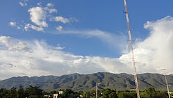
Ajalpan Municipality
Appearance
Ajalpan Municipality | |
|---|---|
 | |
 Location of the municipality in Puebla | |
| Country | |
| State | Puebla |
| Time zone | UTC-6 (Central Standard Time) |
| • Summer (DST) | UTC-5 (Central Daylight Time) |
Ajalpan Municipality is a municipality in the Mexican state of Puebla in south-eastern Mexico.[1]
References
- ^ "-". Enciclopedia de los Municipios de México. Instituto Nacional para el Federalismo y el Desarrollo Municipal. Archived from the original on April 5, 2007. Retrieved January 4, 2010.


