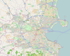
Laughanstown Luas stop
Appearance
 The platforms at Laughanstown | |||||||||||
| General information | |||||||||||
| Location | Dublin Ireland | ||||||||||
| Coordinates | 53°15′02″N 6°09′18″W / 53.25061238006328°N 6.155015453516473°W | ||||||||||
| Owned by | Transdev | ||||||||||
| Operated by | Luas | ||||||||||
| Line(s) | Green | ||||||||||
| Platforms | 2 | ||||||||||
| Construction | |||||||||||
| Structure type | At-grade | ||||||||||
| Other information | |||||||||||
| Fare zone | Green 5 | ||||||||||
| Key dates | |||||||||||
| 16 October 2010 | Stop opened | ||||||||||
| Services | |||||||||||
| |||||||||||
| |||||||||||
| |||||||||||||||||||||||||||||||||||||||||||||||||||||||||||||||||||||||||||||||||||||||||||||||||||||||||||||||||||||||||||||||||||||||||||||||||||||||||||||||||||||||||||||||||||||||||||||||||||||||||||||||||||||||||||||||||||||||||||||||||||||||||||||||||||||||||||||||||||||||||||||||||||||||||||||||||||||||||||||||||||||||||||||||||||||||||||||||||||||||||||||||||||||||
Laughanstown (Irish: Baile an Locháin) is a stop on the Luas light-rail tram system in Dún Laoghaire–Rathdown, County Dublin, Ireland. It opened in 2010 as a stop on the extension of the Green Line south from Sandyford to Brides Glen.[1] The stop provides access to the nearby suburb of Cabinteely.[2]
History
The stop was intended to serve a new suburb being developed during the Celtic Tiger. A lack of subsequent development in the vicinity resulted in Laughanstown being the least used stop on the Luas Network. As of 2022, the land around the stop is again under development and new roads have been constructed close to the stop.
References
- ^ "New Luas extension opens". Irish Times.
- ^ "Laughanstown". Luas.

