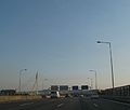
Freixo Bridge
Appearance
Ponte do Freixo | |
|---|---|
 | |
| Coordinates | 41°08′31″N 08°34′46″W / 41.14194°N 8.57944°W |
| Carries | Motor vehicles |
| History | |
| Opened | 1995 |
| Location | |
 | |
The Freixo Bridge (Template:Lang-pt) which was inaugurated in 1995 is a Portuguese bridge over the Douro river, connecting Vila Nova de Gaia and Porto. The purpose of its construction was to create an alternative to Arrábida and D. Luis I bridges. The designers of the bridge are António Reis and Daniel de Sousa. The bridge with total length of 705 m has 8 spans.[1]
Gallery
-
Ponte do Freixo (Porto)
-
Ponte do Freixo (34011316175)
-
Trânsito na Ponte do Freixo
-
FrEixo (4386401013)
References
External links
 Media related to Ponte do Freixo at Wikimedia Commons


