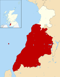
Maidens, South Ayrshire
Appearance

Maidens is a village in the Kirkoswald parish of Ayrshire, Scotland. Situated on the coast of the Firth of Clyde at the southern end of Maidenhead Bay, a series of rocks known as the "Maidens of Turnberry" form a natural harbour. The village lies two miles north of the ruinous Turnberry Castle, ancient seat of the Earls of Carrick, and five miles west of Maybole. It formerly had its own railway station on the Maidens and Dunure Light Railway. At 1991, Maidens had a population of 567.
References
- "Maidens". The Gazetteer for Scotland. Retrieved 5 October 2015.
External links
Wikimedia Commons has media related to Maidens, South Ayrshire.
55°20′N 4°49′W / 55.333°N 4.817°W

