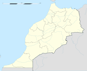
Ghafsai
Ghafsai
Ɣefsay (in Berber) | |
|---|---|
Town | |
| Coordinates: 35°01′22″N 4°08′27″W / 35.0228°N 4.14083°W | |
| Country | |
| Region | Fès-Meknès |
| Province | Taounate Province |
| Population (2014)[1] | |
| • Total | 6,361 |
| Time zone | UTC+0 (WET) |
| • Summer (DST) | UTC+1 (WEST) |
Ghafsai (Berber languages: Ɣefsay, Arabic: غفساي) is a town in the Tawnat Province, in the region of Fas-Meknas, Morocco. It is located in the Rif Mountains.[2] As of the 2014 Moroccan census, Ghafsai has 6,361 inhabitants.[1]
History
After being controlled by the Kingdom of Morocco in the previous decades, Ghafsai was within Spanish Morocco from 1912 to 1921,[3] and then the Rif Republic ruled over the Rif region, including Ghafsai, from 1921 to 1926.[4] In the Rif War of the 1920s Interwar Period, Ghafsai was within the warzone.[5] After the Rif Republic lost the war, the area returned under Spanish control.[6]
During the Ifni War in the 1950s, the Moroccan Army of Liberation used Ghafsai as one of their centers of operations against the Spanish and French.[7]
In January 2016, 18 urban development projects spanning over 22 hectares (54 acres) of land were announced to be in progress. Grants for a house relocation project totaled 8.63 million Moroccan dirhams, while the cost for a new sewage system was estimated at 47 million dirhams. Construction of a shopping center, a school, a sports complex, car parking area, economic development area, parks, a landfill, and an electrical network overhaul are also planned. In total, all of these new projects are estimated to add up to the cost of over 300 million dirhams.[8]
Geography
Ghafsai is located in the Rif Mountains in the northern part of Morocco.[2]
Economy
Ghafsai is one of the major producers of cannabis in Morocco,[2] but in recent years other agriculture and beekeeping ventures have developed also.[9] Faba beans and barley are also produced in Ghafsai.[10]
References
- ^ a b "Population légale d'après les résultats du RGPH 2014 sur le Bulletin officiel N° 6354" (pdf). Haut-Commissariat au Plan (in Arabic). Retrieved 11 July 2015.
- ^ a b c Raphael Chijioke Njoku (2006). Culture and Customs of Morocco. Greenwood Publishing Group. p. 2. ISBN 978-0-313-33289-0.
- ^ "Treaty Between France and Spain Regarding Morocco". The American Journal of International Law. 7 (2 [Supplement: Official Documents]): 81–99. 1913. doi:10.2307/2212275.
- ^ Day, Richard B.; Gaido, Daniel. Discovering Imperialism: Social Democracy to World War I. BRILL. p. 549. ISBN 9004201564. Retrieved 14 September 2016.
- ^ Dirk Sasse (1 January 2006). Franzosen, Briten und Deutsche im Rifkrieg 1921-1926: Spekulanten und Sympathisanten, Deserteure und Hasardeure im Dienste Abdelkrims. De Gruyter. p. 129. ISBN 978-3-486-84018-6.
- ^ Douglas Porch, "Spain's African Nightmare," MHQ: Quarterly Journal of Military History (2006) 18#2 pp 28–37.
- ^ Douglas Elliott Ashford (8 December 2015). Political Change in Morocco. Princeton University Press. p. 201. ISBN 978-1-4008-7850-5.
- ^ "Plus de 300 MDH pour l'aménagement urbain de la ville de Ghafsaï". Medias24 - Site d'information. Retrieved 22 October 2016.
- ^ "Mieux que le bio, l'agroécologie". Telquel.ma. 16 July 2014. Retrieved 22 October 2016.
- ^ Crop Genetic Diversity to Reduce Pests and Disease On-farm. Bioversity International. 2006. p. 36. ISBN 978-92-9043-726-0.


