
Westerkappeln
Westerkappeln | |
|---|---|
 Coat of arms | |
Location of Westerkappeln within Steinfurt district 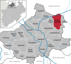 | |
 Westerkappeln  Westerkappeln | |
| Coordinates: 52°22′50″N 7°36′00″E / 52.38056°N 7.60000°E | |
| Country | Germany |
| State | North Rhine-Westphalia |
| Admin. region | Münster |
| District | Steinfurt |
| Subdivisions | 3 |
| Government | |
| • Mayor | Anette Große-Heitmeyer (CDU) |
| Area | |
| • Total | 85.78 km2 (33.12 sq mi) |
| Elevation | 60 m (200 ft) |
| Population (2022-12-31)[1] | |
| • Total | 11,485 |
| • Density | 130/km2 (350/sq mi) |
| Time zone | UTC+01:00 (CET) |
| • Summer (DST) | UTC+02:00 (CEST) |
| Postal codes | 49492 |
| Dialling codes | 05404 |
| Vehicle registration | ST (until 1975: TE) |
| Website | www.gemeinde-westerkappeln.de |
Westerkappeln is a municipality in the district of Steinfurt, in North Rhine-Westphalia, Germany. It is situated approximately 15 km north-west of Osnabrück.
Towns and municipalities in Steinfurt (district) | ||
|---|---|---|
 | ||
References
| International | |
|---|---|
| National | |
| Geographic | |
This Steinfurt district location article is a stub. You can help Wikipedia by expanding it. |