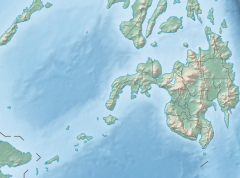
Allah River
Appearance
| Allah River | |
|---|---|
Allah River mouth | |
| Location | |
| Country | Philippines |
| Region | Soccsksargen |
| Province | |
| Physical characteristics | |
| Source | Lake Holon |
| • location | T'Boli, South_Cotabato |
| 2nd source | Lake Sebu |
| • location | Lake Sebu, South Cotabato |
| Mouth | Mindanao River |
| Basin features | |
| Tributaries | |
| • right |
|
The Allah River flows through the Allah Valley on the island of Mindanao in the Philippines. It is located in the provinces of South Cotabato and Sultan Kudarat. It is 120 kilometres (75 mi) in length.
Its sources are Surallah, Lake Holon, and Lake Sebu. Its tributaries include the Kapingkong River and the Ga-o River. It empties into the Mindanao River.
It is partially controlled by the Allah River Irrigation Project, which includes several dams.[1]
References
- ^ Valera, Alfredo (ed.) (1988). Crop diversification in irrigated agriculture in the Philippines. International Irrigation Management Institute. p. 266.
{{cite book}}:|first=has generic name (help)


