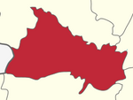
Karimangalam taluk
Appearance
Karimangalam taluk is a taluk in the Dharmapuri district of the Indian state of Tamil Nadu.[1] On 10 February 2016, Karimangalam taluk was formed by merging parts of Palacode and Harur taluks of Dharmapuri district. The headquarters of the taluk is the town of Kariamangalam. This taluk contains a total of 52 panchayat villages.[2]
References
- ^ "Dharmapuri District Profile". Retrieved 20 June 2016.
- ^ "GO - Karimangalam Taluk formation" (PDF). Government of Tamil Nadu. Retrieved 20 June 2016.

