Kilgobnet
Appearance
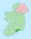
Kilgobnet (Irish: Cill Ghobnait, meaning 'church of Gobnait')[1] is one of 74 civil parishes in County Waterford, Ireland. Located within the Diocese of Waterford and Lismore,[2] according to Samuel Lewis's Topographical Dictionary of Ireland, the parish had a population of approximately 3,000 inhabitants in 1837.[3]
References
- ^ "Cill Ghobnait / Kilgobnet". logainm.ie. Irish Placenames Commission. Retrieved 9 August 2019.
- ^ "Diocese of Waterford and Lismore - County of Waterford - Kilgobnet". National Library of Ireland. Retrieved 9 August 2019.
- ^ "Lewis's Topographical Dictionary - Waterford County - Kilgobinet". Waterford Museum. Retrieved 9 August 2019.

