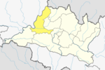
Dhuwakot
Appearance
Dhuwakot
धुवाकोट | |
|---|---|
 | |
| Country | |
| Zone | Gandaki Zone |
| District | Gorkha District |
| Population (1991) | |
• Total | 4,270 |
| • Religions | Hindu Buddhist |
| Time zone | UTC+5:45 (Nepal Time) |
Dhuwakot is a village development committee in Gorkha District in the Gandaki Zone of central Nepal. In 1991 Nepal census, it had a population of 4270 with 781 houses in it. Such as Mirkot, Gaikhur, Palumtar are the neighbouring VDCs of Dhuwakot VDC.There are mainly Naharki's(नहर्की) caste is more in an average than others. [1]
References
- ^ "Nepal Census 2001". Nepal's Village Development Committees. Digital Himalaya. Archived from the original on 2008-10-12. Retrieved 2008-08-24.

