
BR-285 (Brazil highway)
This article has multiple issues. Please help improve it or discuss these issues on the talk page. (Learn how and when to remove these template messages)
|
 | |
|---|---|
 | |
| Route information | |
| Length | 674.5 km[1] (419.1 mi) |
| Major junctions | |
| East end | Araranguá, Santa Catarina |
BR-470 in Lagoa Vermelha BR-158 in Panambi | |
| West end | São Borja, Rio Grande do Sul |
| Location | |
| Country | Brazil |
| Highway system | |
BR-285 is an east-west Brazilian federal highway that starts in Araranguá, Santa Catarina, and crosses the Gaucho range and highlands. It stretches approximately 674.5 km, passing through cities such as Vacaria, Lagoa Vermelha, Passo Fundo, Carazinho, Ijuí e São Luiz Gonzaga, and ends in São Borja, Rio Grande do Sul, on the border of Argentina.
Gallery
-
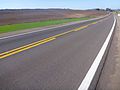 BR-285 in Lagoa Vermelha.
 -
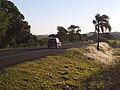 BR-285 in Panambi, in Northwestern Rio Grande do Sul.
 -
 Bridge on the Caxambu River on BR-285 in Panambi.


References
- ^ "BR-285 length between major junctions". Ministério dos Transportes do Brasil. Archived from the original on November 22, 2012. Retrieved August 24, 2014.
| Radial highways (originating from Brasília) | |
|---|---|
| North-south highways | |
| East-west highways | |
| Diagonal highways | |
| Link highways |
|
This article about the roads and road transport of Brazil is a stub. You can help Wikipedia by expanding it. |