A26 road
| A26 | |
|---|---|
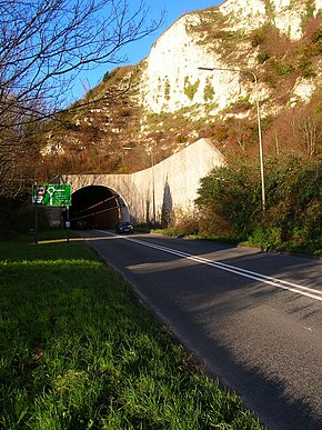
 A26 Cuilfail Tunnel in Lewes | |
| Major junctions | |
| North east end | Maidstone |
| South west end | Newhaven |
| Location | |
| Country | United Kingdom |
| Primary destinations | Tunbridge Wells, Tonbridge, Maidstone, Lewes |
| Road network | |
This article needs additional citations for verification. (April 2018) |
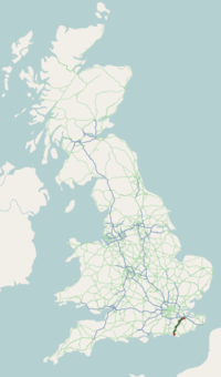
The A26 road is primary route in the southeast of England. It carries traffic from Maidstone in Kent in a generally south-westerly direction to Tunbridge Wells and then on to Newhaven in East Sussex. It begins its journey up the Medway valley to Tonbridge; from there it crosses the Weald through Tunbridge Wells, Crowborough and Uckfield; and thence follows the River Ouse to its mouth at Newhaven, bypassing Lewes by means of a road tunnel. The road is almost entirely single carriageway resulting in congestion. The original[when?] A26 at Lewes headed to Brighton roughly following the modern day A27 up to the mid 1950s [citation needed]. The road, along with the aforementioned A25 and A27, is responsible for the Brighton & Hove bus service routes, a somewhat misleading name considering the A26 in particular does not intersect Brighton. The road runs for a total distance of some 50 miles (80 kilometres) and provides access to the North Kent area and its industrial base with the ferry port of Newhaven. In consequence it has a large Heavy Goods Vehicle usage.
Distinguishing features
When entering Lewes from the direction of Uckfield, one is met with a view of the chalk cliffs at the very edge of the South Downs. Following this you will enter the Cuilfail Tunnel, constructed in 1983, which leaves at the roundabout The Culfail Spiral, a sculpture created by Peter Randall-Page.
External links
![]() Media related to A26 road (England) at Wikimedia Commons
Media related to A26 road (England) at Wikimedia Commons
51°03′20″N 0°09′17″E / 51.05542°N 0.15484°E


