
Lariang River
| Lariang River Sungai Lariang, Salu Lariang, Uwai Lariang | |
|---|---|
| Native name | Salo Lariang Error {{native name checker}}: parameter value is malformed (help) |
| Physical characteristics | |
| Source | |
| • location | Sulawesi |
| Mouth | Macassar Strait |
• location | Lariang, West Sulawesi |
• coordinates | 1°25′00″S 119°17′31″E / 1.41667°S 119.29194°E |
• elevation | 0 m (0 ft) |

Lariang
Mouth of Lariang River
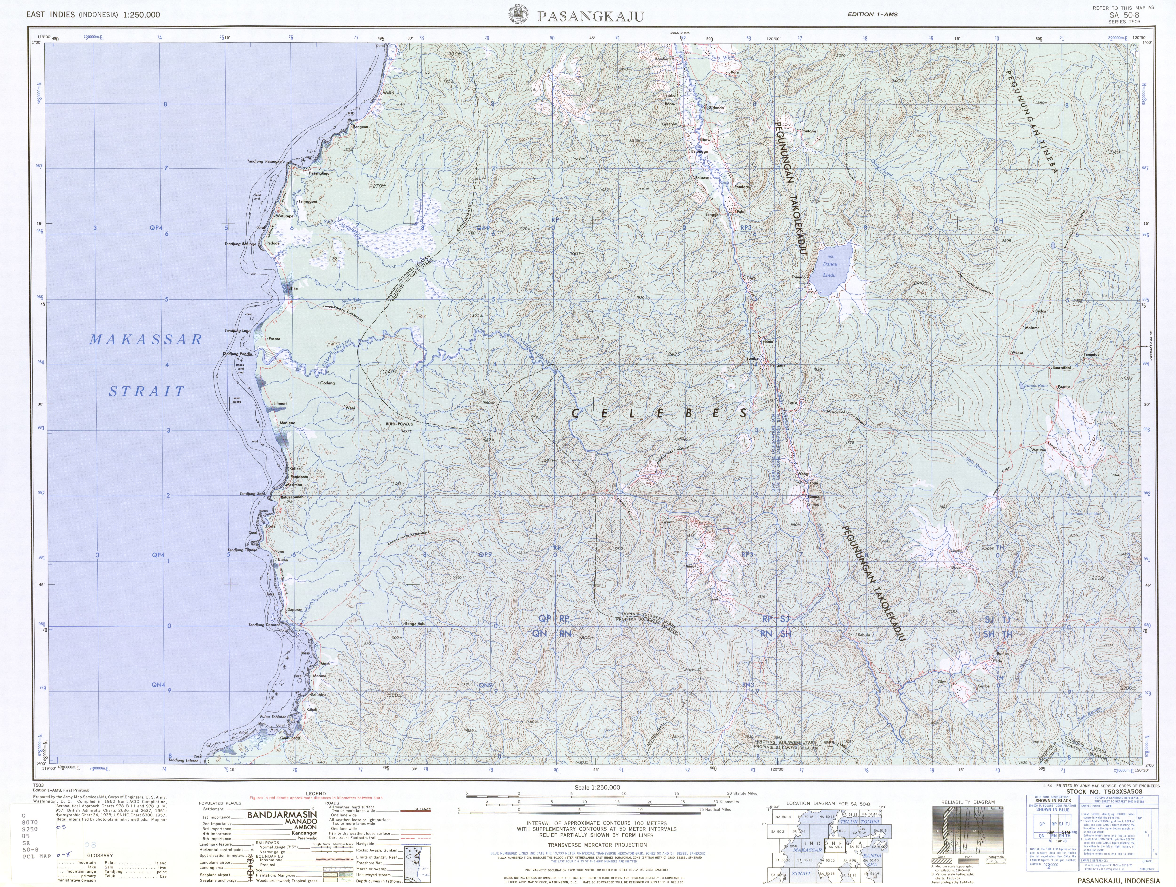
Lariang River is a river in Sulawesi, Indonesia.[1]
Course
Its tributary, the Pebatua River, arises in Donggala Regency, Central Sulawesi, and forms the Lariang when it is joined by the Koro River from the left (south) at 1°39′50″S 120°2′47″E / 1.66389°S 120.04639°E.[2] The river, as the Lariang,[3] goes on to form part of the border between Central Sulawesi and West Sulawesi and enters the Macassar Strait just past the town of Lariang.[4][5] The mouth is at 1°25′00″S 119°17′31″E / 1.41667°S 119.29194°E.
See also
References
- ^ Rand McNally, The New International Atlas, 1993.
- ^ Pasangkaju, SA 50-8 (topographic map 1:250,000), Series T503, United States Army Map Service, April 1964
- ^ Some maps such as "Lariang, Sulawesi Barat, Sulawesi, Indonesia". Collins Maps. Archived from the original on 2013-06-28. and "City (town): Lariang". TipTopGlobe. no longer use the name Lariang, but use Pebatua for the entire length.
- ^ "Plate 19 Indonesia Central: Philippines". Times Atlas of the World (seventh ed.). John Bartholomew and Sons, Ltd. 1985. ISBN 978-0-7230-0265-9.
- ^ The 1964 U.S. Army topographic map Pasangkaju does not show the town of Lariang.