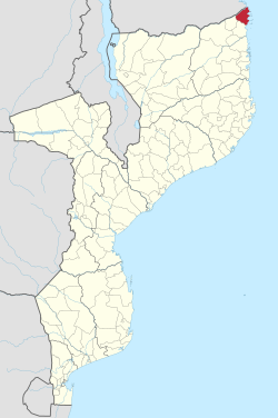
Palma District
Appearance
This article relies largely or entirely on a single source. (July 2015) |
Palma District | |
|---|---|
 District location in Mozambique | |
| Country | |
| Province | Cabo Delgado Province |
| Capital | Palma |
| Area | |
| • Total | 3,576 km2 (1,381 sq mi) |
| Population (2015) | |
| • Total | 52,269 |
| • Density | 15/km2 (38/sq mi) |
| Time zone | UTC+2 (EAT) |
Palma District is a district of Cabo Delgado Province in northern Mozambique. It covers 3,576 km² with 52,269 inhabitants (2015). Its principal town is Palma.
External links
- Government profile (in Portuguese)
