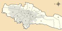
La Isla (wetland)
Appearance
| La Isla Humedal La Isla | |
|---|---|
| Location | Bosa, Bogotá |
| Coordinates | 4°37′05.2″N 74°12′47.3″W / 4.618111°N 74.213139°W |
| Area | 7.7 ha (19 acres) |
| Elevation | 2,550 m (8,370 ft) |
| Administrator | EAAB - ESP |
| Website | Humedal La Isla |
La Isla is a small wetland, part of the wetlands of Bogotá. It is located next to the Tunjuelo River in the locality Bosa, Bogotá, Colombia. The Bogotá River passes 800 metres (2,600 ft) south of the wetland with an area of 7.7 hectares (19 acres).[1]
See also[edit]
References[edit]
- ^ (in Spanish) Humedal La Isla
Further reading[edit]
- Andrade L., Martha Esperanza, and Henry Benitez Castañeda. s.a. Los Humedales de la Sabana de Bogotá: Área Importante para la Conservación de las Aves de Colombia y el Mundo, 1-38. AICAS. Accessed 2017-03-03.
- Moreno, Vanesa; Juan Francisco García, and Juan Carlos Villalba. s.a. Descripción general de los humedales de Bogotá D.C., 1-28. Sociedad Geográfica de Colombia. Accessed 2017-03-03.
External links[edit]
- (in Spanish) Fundación Humedales de Bogotá
- (in Spanish) Conozca los 15 humedales de Bogotá - El Tiempo


