
Longpré-le-Sec
You can help expand this article with text translated from the corresponding article in French. (December 2008) Click [show] for important translation instructions.
|
Longpré-le-Sec | |
|---|---|
 The main road in Longpré-le-Sec | |
Location of Longpré-le-Sec  | |
 Longpré-le-Sec  Longpré-le-Sec | |
| Coordinates: 48°11′18″N 4°31′30″E / 48.1883°N 4.525°E | |
| Country | France |
| Region | Grand Est |
| Department | Aube |
| Arrondissement | Bar-sur-Aube |
| Canton | Vendeuvre-sur-Barse |
| Government | |
| • Mayor (2008–2014) | Guy Roblot |
| Area 1 | 15.71 km2 (6.07 sq mi) |
| Population (2021)[1] | 77 |
| • Density | 4.9/km2 (13/sq mi) |
| Time zone | UTC+01:00 (CET) |
| • Summer (DST) | UTC+02:00 (CEST) |
| INSEE/Postal code | 10205 /10140 |
| Elevation | 211 m (692 ft) |
| 1 French Land Register data, which excludes lakes, ponds, glaciers > 1 km2 (0.386 sq mi or 247 acres) and river estuaries. | |
Longpré-le-Sec is a commune in the Aube department in north-central France.
Population
| Year | Pop. | ±% |
|---|---|---|
| 1962 | 117 | — |
| 1968 | 129 | +10.3% |
| 1975 | 108 | −16.3% |
| 1982 | 100 | −7.4% |
| 1990 | 92 | −8.0% |
| 1999 | 80 | −13.0% |
| 2008 | 85 | +6.2% |
See also
References
- ^ "Populations légales 2021" (in French). The National Institute of Statistics and Economic Studies. 28 December 2023.
-
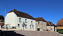 Street in Longpré-le-Sec
 -
 View of the village
 -
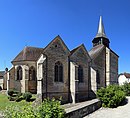 St Peter's church of Longpré-le-Sec
 -
 War memorial
 -
 Monument near the church


Wikimedia Commons has media related to Longpré-le-Sec.
| Authority control databases: National |
|---|
This Aube geographical article is a stub. You can help Wikipedia by expanding it. |