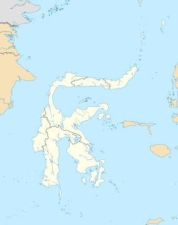
Southeast Peninsula, Sulawesi
Appearance
| Geography | |
|---|---|
| Location | Southeast Asia |
| Coordinates | 4°S 122°E / 4°S 122°E |
| Adjacent to | Banda Sea Gulf of Tolo Gulf of Boni |
| Administration | |
| Province | |
| Largest settlement | Kendari |
The Southeast Peninsula is a peninsula of Sulawesi (Celebes), lying between the Gulf of Tolo and the Gulf of Boni. It is mostly coterminous with the province of Southeast Sulawesi. The largest city on the peninsula is Kendari.
Several islands are situated off its south-eastern tip, including Muna and Buton.
See also
- East, South, and Minahassa Peninsulas
References

