
Brushvale, Minnesota
Brushvale | |
|---|---|
 Brushvale  Brushvale | |
| Coordinates: 46°22′10″N 96°38′36″W / 46.36944°N 96.64333°W | |
| Country | United States |
| State | Minnesota |
| County | Wilkin |
| Elevation | 951 ft (290 m) |
| Time zone | UTC-6 (Central (CST)) |
| • Summer (DST) | UTC-5 (CDT) |
| Area code | 218 |
| GNIS feature ID | 654618[1] |
Brushvale is an unincorporated community in Wilkin County, in the U.S. state of Minnesota.[1]
History
A post office called Brushvale was established in 1902, and remained in operation until 1954.[2] The community was named for Joseph Brush, the original owner of the town site.[3]
References
- ^ a b U.S. Geological Survey Geographic Names Information System: Brushvale, Minnesota
- ^ "Wilkin County". Jim Forte Postal History. Retrieved 14 August 2015.
- ^ Upham, Warren (1920). Minnesota Geographic Names: Their Origin and Historic Significance. Minnesota Historical Society. p. 578.
Municipalities and communities of Wilkin County, Minnesota, United States | ||
|---|---|---|
| Cities | 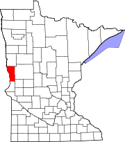 | |
| Townships | ||
| Unincorporated communities | ||
| Footnotes | ‡This populated place also has portions in an adjacent county or counties | |