St Mary Peak
| St Mary Peak (Ngarri Mudlanha) | |
|---|---|
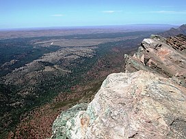
 St Mary Peak, view east from the summit | |
| Highest point | |
| Elevation | 1189[1] |
| Coordinates | 31°30′14″S 138°33′00″E / 31.504°S 138.55°E[2] |
| Geography | |
| Parent range | Flinders Ranges |
| Climbing | |
| Easiest route | Hike |
St Mary Peak (Adnyamathanha name: Ngarri Mudlanha) is a mountain located in the Australian state of South Australia on the northwestern side of Wilpena Pound. It is the highest peak in the Flinders Ranges and the eighth highest peak in South Australia, with a height of 1,189 metres (3,901 ft).[2] It is located within the Flinders Ranges National Park and the gazetted locality of Flinders Ranges, South Australia. It was formerly known as "St Mary's Peak", but was renamed according to guidelines deprecating the use of names implying possession.[3] Its former name remains in colloquial use.
The Adnyamathanha people have expressed concern with tourists trekking to St Mary Peak as they regard it as a sacred place and not to be visited.[4][5] However, the peak and its surroundings may be accessed via a walking trail from Wilpena Resort along the north-east edge of the range outside of Wilpena Pound, or via a longer trail through the middle of the pound.[6]
See also
References
- ^ Britannica Concise Encyclopedia. Encyclopædia Britannica. 2008. p. 682. ISBN 9781593394929. Retrieved 14 August 2015.
- ^ a b c "Search result for "St Mary Peak (Hill)" (Record no. SA0060083) with the following layers selected - "Suburbs and Localities" and " Place names (gazetteer)"". Property Location Browser. Government of South Australia. Retrieved 6 August 2016.
- ^ "Geographical names guidelines". 16 March 2016. Retrieved 2 October 2017.
- ^ "Why hikers should stay off this peak". Retrieved 2 September 2017.
- ^ "St Mary Peak Hike, Wilpena Pound | Walking SA". Walking SA. Retrieved 2 September 2017.
- ^ Bushwalking in Flinders Ranges National Park - Dept of Environment and Heritage. Retrieved 9 January 2007 Archived September 19, 2006, at the Wayback Machine
External links


