Alférez FAP Alfredo Vladimir Sara Bauer Airport
Alférez FAP Vladimir Sara Bauer Airport Andoas Airport | |||||||||||
|---|---|---|---|---|---|---|---|---|---|---|---|
| Summary | |||||||||||
| Airport type | Public | ||||||||||
| Operator | CORPAC S.A. | ||||||||||
| Serves | Andoas, Peru | ||||||||||
| Elevation AMSL | 728 ft / 222 m | ||||||||||
| Coordinates | 2°47′45″S 76°28′00″W / 2.79583°S 76.46667°W | ||||||||||
| Map | |||||||||||
| Runways | |||||||||||
| |||||||||||
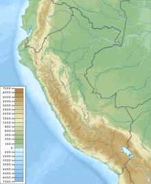
Alférez FAP Alfredo Vladimir Sara Bauer Airport (official name Alférez FAP Vladimir Sara Bauer Airport) (IATA: AOP, ICAO: SPAS) is a small regional airport serving Andoas, in the northern Loreto Region of Peru. It is currently not served by any scheduled airline but it is by private and charter airlines. The airport is less than 1 kilometre (0.62 mi) in from the Pastaza River and is 20 kilometres (12 mi) downstream from the Peruvian border with Ecuador.
The Andoas VOR-DME (Ident: OAS) is located on the field.[4]
The airport is named after Vladimir Enrique Sara Bauer, who died in a helicopter accident on October 6, 1977.
Airlines and destinations
| Airlines | Destinations |
|---|---|
| Star Perú | Charter: Iquitos, Lima |
See also
References
- ^ Airport information for SPAS from DAFIF (effective October 2006)
- ^ Airport information for SPAS at Great Circle Mapper.
- ^ Google Maps - Andoas
- ^ SkyVector OAS VOR
External links
- Accident history for SPAS at Aviation Safety Network
- OpenStreetMap - Andoas
- OurAirports - Andoas
- SkyVector Aeronautical Charts

