Cat Cays Airport
Appearance
Cat Cay Airport | |||||||||||
|---|---|---|---|---|---|---|---|---|---|---|---|
| Summary | |||||||||||
| Airport type | PRIVATE | ||||||||||
| Serves | North Cat Cay | ||||||||||
| Location | Bahamas | ||||||||||
| Elevation AMSL | 0 ft / 0 m | ||||||||||
| Coordinates | 25°33′19.0″N 79°16′33.8″W / 25.555278°N 79.276056°W | ||||||||||
| Map | |||||||||||
| Runways | |||||||||||
| |||||||||||
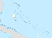
Cat Cay Airport (IATA: CXY, ICAO: MYCC) is a private airport located on North Cat Cay, the Bahamas. The airport is for the exclusive use of the Cat Cay Yacht Club and requires permission to land. It has the 21st shortest runway in the world, and the 2nd shortest for an ICAO named airport.
See also
References
- ^ Airport record for Cat Cay Airport at Landings.com. Retrieved 2013-08-08
- ^ Google (2013-08-08). "location of Cat Cay Airport" (Map). Google Maps. Google. Retrieved 2013-08-08.
External links
- Airport record for Cat Cay Airport at Landings.com

