Great Harbour Cay Airport
Great Harbour Cay Airport | |||||||||||
|---|---|---|---|---|---|---|---|---|---|---|---|
| Summary | |||||||||||
| Airport type | Private | ||||||||||
| Serves | Great Harbour Cay, Berry Islands, Bahamas | ||||||||||
| Elevation AMSL | 18 ft / 5 m | ||||||||||
| Coordinates | 25°44′18″N 077°50′24″W / 25.73833°N 77.84000°W | ||||||||||
| Map | |||||||||||
| Runways | |||||||||||
| |||||||||||
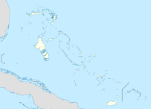
Great Harbour Cay Airport (IATA: GHC, ICAO: MYBG) is an airport serving Great Harbour Cay, one of the Berry Islands in The Bahamas.[1]
Facilities
The airport resides at an elevation of 18 ft (5.5 m) above mean sea level. It has one runway designated 13/31 with an asphalt surface measuring 1,372 m × 30 m (4,501 ft × 98 ft).[1]
Airlines and destinations
| Airlines | Destinations |
|---|---|
| Flamingo Air | Freeport[3] |
| Tropic Ocean Airways | Fort Lauderdale |
References
- ^ a b c Template:WAD
- ^ Airport information for GHC at Great Circle Mapper. Source: DAFIF (effective October 2006).
- ^ http://flytropic.com/scheduled-flights
External links

