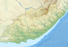
Plettenberg Bay Aerodrome
Plettenberg Bay Aerodrome | |||||||||||||||
|---|---|---|---|---|---|---|---|---|---|---|---|---|---|---|---|
| Summary | |||||||||||||||
| Airport type | Public | ||||||||||||||
| Owner/Operator | Airports Company South Africa | ||||||||||||||
| Serves | Plettenberg Bay, South Africa | ||||||||||||||
| Elevation AMSL | 466 ft / 142 m | ||||||||||||||
| Coordinates | 34°5′17″S 023°19′43″E / 34.08806°S 23.32861°E | ||||||||||||||
| Map | |||||||||||||||
| Runways | |||||||||||||||
| |||||||||||||||
Plettenberg Bay Aerodrome[citation needed][1] (IATA: PBZ[2], ICAO: FAPG) is a small airport serving Plettenberg Bay, a town in the Western Cape province in South Africa.
Airlines and destinations
| Airlines | Destinations |
|---|---|
| CemAir | Cape Town, Johannesburg–O.R. Tambo[3] |
See also
References
- ^ Bloemfontein Airport Archived 20 July 2011 at the Wayback Machine - official site
- ^ "IATA Airport Code Search (PBZ: Plettenberg Bay Aerodrome)". International Air Transport Association. Retrieved 17 June 2013.
- ^ https://www.businesstravellerafrica.co.za/cemair-resumes-flights/


