Sebba Airport
Appearance
Sebba Airport | |||||||||||
|---|---|---|---|---|---|---|---|---|---|---|---|
| Summary | |||||||||||
| Serves | Sebba, Yagha Province, Sahel Region, Burkina Faso | ||||||||||
| Location | |||||||||||
| Elevation AMSL | 270 m / 886 ft | ||||||||||
| Coordinates | 13°27′24″N 0°30′10″E / 13.45667°N 0.50278°E | ||||||||||
| Maps | |||||||||||
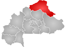
 Sahel Region in Burkina Faso | |||||||||||
 | |||||||||||
| Runways | |||||||||||
| |||||||||||
Sebba Airport (IATA: XSE, ICAO: DFES) is an airport serving the village of Sebba in the Yagha Province, part of the Sahel Region of Burkina Faso.
The runway is unmarked and its length is estimated.
See also
References
- ^ Bing Maps - Sebba
- ^ Airport record for Sebba Airport at Landings.com. Retrieved 2013-08-22
- ^ "location of Sebba Airport" (Map). Google Maps. Retrieved 2013-08-22.
- ^ Airport information for Sebba Airport at Transport Search website.
External links
- Airport record for Sebba Airport at Landings.com

