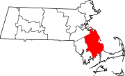
South Plymouth, Massachusetts
South Plymouth is the portion of Plymouth, Massachusetts, United States that covers much of the southern section of the town beginning at the Pine Hills, a large, mostly undeveloped forested area south of Plymouth Beach, Chiltonville and South Pond. The remainder of the section is south and east of the northeastern entrance to Myles Standish State Forest, stretching to the Bourne and Wareham town lines.
Villages and neighborhoods in South Plymouth are:
- Rocky Point
- The Pinehills
- Buttermilk Bay
- Manomet
- Priscilla Beach
- White Horse Beach
- Manomet Heights
- Manomet Bluffs
- Fishermans Landing
- Churchill Landing
- Colony Beach
- Pilgrim Beach
- Cedar Bushes
- Manomet Beach
- Vallerville
- Ocean Aire Beach
- Surfside Beach
- Bayside Beach
- Ellisville
- Harlow's Landing
- Eastland Heights
- Cedarville
- Nameloc Heights
- Pondville
- Halfway Pond
- Long Pond
- West Wind Shores
- White Island Shores
See also
41°52′N 70°34′W / 41.87°N 70.57°W

