
Bobrynets
Bobrynets
Бобринець | |
|---|---|
 St Nicholas Church in Bobrynets | |
 Flag  Coat of arms | |
| Country | Ukraine |
| Oblast | Kirovohrad Oblast |
| Population (2018) | |
| • Total | 10,846[1] |
Bobrynets (Ukrainian: Бо́бринець, Russian: Бо́бринец, Yiddish: בוברניץ) is a city in Kirovohrad Oblast (province) of Ukraine. It serves as the administrative center of Bobrynets Raion.
History
Settlement in the Yelisavetgradsky Uyezd of the Kherson Governorate of the Russian Empire.
At the beginning of the 20th century, the Jewish population of the town was 3,500 inhabitants. During the Russian civil war (1918–1920), 160 Jews were killed during pogroms. Many left the city before the Germans occupied the area. In 1941, they were kept prisoners in a ghetto. At the beginning of 1942, 358 Jews were murdered in mass executions perpetrated in the nearby forest.[2]
In 1968 population was 11 600 people[3].
In 1989 population was 12 869 people[4][5].
In 2013 population was 10 991 people[6].
Gallery
-
 Ascension Church in Bobrynets
 -
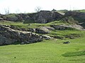 Nature park in Bobrynets
 -
 Administrative building
 -
 Bobrynets in Winter
 -
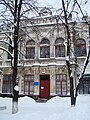 City museum
 -
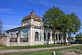 Synagogue


References
- ^ Чисельність наявного населення України на 1 січня 2018 року. Державна служба статистики України. Київ, 2018. стор.41
- ^ http://www.yadvashem.org/yv/he/research/ghettos_encyclopedia/ghetto_details.asp?cid=100
- ^ Бобринец // Большая Советская Энциклопедия. / под ред. А. М. Прохорова. 3-е изд. том 3. М., «Советская энциклопедия», 1970.
- ^ Всесоюзная перепись населения 1989 г. Численность городского населения союзных республик, их территориальных единиц, городских поселений и городских районов по полу
- ^ Бобринец // Большой энциклопедический словарь (в 2-х тт.). / редколл., гл. ред. А. М. Прохоров. том 1. М., "Советская энциклопедия", 1991.
- ^ Чисельність наявного населення України на 1 січня 2013 року. Державна служба статистики України. Київ, 2013. стор.70
| International | |
|---|---|
| National | |
| Geographic | |
48°3′28″N 32°9′29″E / 48.05778°N 32.15806°E
This article about a location in Kirovohrad Oblast is a stub. You can help Wikipedia by expanding it. |