Wilburtha, New Jersey
Appearance
Wilburtha, New Jersey | |
|---|---|
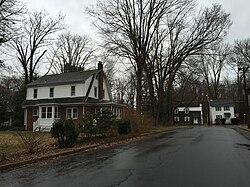
 Homes at the intersection of Blackwood Drive and Wilburtha Road in the Wilburtha section of Ewing, New Jersey | |
| Coordinates: 40°15′07″N 74°49′57″W / 40.25194°N 74.83250°W | |
| Country | |
| State | |
| County | Mercer |
| Township | Ewing |
| Elevation | 62 ft (19 m) |
| GNIS feature ID | 881825[1] |
Wilburtha is a section of Ewing Township in Mercer County, New Jersey, United States.[2] Located where Wilburtha Road crosses the Delaware and Raritan Canal,[3] it is one of the oldest settlements in Ewing Township and developed due to the construction of the canal in the early 19th century. The community was known as Greensburg before adopting its current name in 1883.[4] The Yardley–Wilburtha Bridge once connected Wilburtha to Yardley, Pennsylvania on the other side of the Delaware River.[5] The Belvidere Delaware Railroad once passed through the village. Today, Wilburtha is primarily a residential neighborhood consisting of detached, single-family homes, the majority of which were built in the 1950s through the early 1980s.[6]
References
- ^ a b "Wilburtha". Geographic Names Information System. United States Geological Survey, United States Department of the Interior.
- ^ Locality Search, State of New Jersey. Accessed January 7, 2015.
- ^ Gannett, Henry (February 24, 1895). "A Geographic Dictionary of New Jersey". U.S. Government Printing Office – via Google Books.
- ^ Jo Ann Tesauro (2002). Images of America: Ewing Township. Arcadia Publishing. p. 7. ISBN 0-7385-1040-8.
The Greensburg/Wilburtha section was built up after the Delaware and Raritan Canal was built in 1834. The village contained 30 homesteads, a general store, a post office, a tavern, a railroad station on the Belvidere-Delaware (Bel-Del) line, and numerous quarries. Along with the canals, the quarries used the railroad to transport their product known as Greensburg Stone or Trenton Brown Stone. Greensburg was renamed Wilburtha in 1883.
- ^ Dale, Frank T. (February 24, 2003). "Bridges Over the Delaware River: A History of Crossings". Rutgers University Press – via Google Books.
- ^ "Wilburtha, Ewing Township, New Jersey". livingplaces.com. Retrieved 2015-01-18.
Wilburtha is a neighborhood of detached single family homes built during the 1950s (Blackwood Drive, Boxwood Court, Middleton Avenue, Ramson Avenue, Wakefield Drive, Wilburtha Road) and the 1980s (Locke Court, Riverview Drive, Wilburtha Road). Access to the Wilburtha neighborhood is from River Road onto Wilburtha Road or Upper Ferry Road West onto Riverview Drive.


