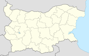
Chamla
You can help expand this article with text translated from the corresponding article in Bulgarian. (December 2008) Click [show] for important translation instructions.
|
Chamla
Чамла | |
|---|---|
Village | |
 | |
| Coordinates: 41°37′N 24°27′E / 41.617°N 24.450°E | |
| Country | |
| Province | Smolyan Province |
| Municipality | Smolyan |
| Abandoned | 1980s |
| Elevation | 5,410 ft (1,650 m) |
| Population (2015) | |
• Total | 0 |
| Time zone | UTC+2 (EET) |
| Postal code | 4848 |
| Vehicle registration | СМ |

Chamla (Template:Lang-bg) is an abandoned village in the municipality of Smolyan, located in the Smolyan Province of southern Bulgaria. The village is located 150.9 km from Sofia.[2]
Geography
Chamla is formally the highest village in Bulgaria, even though it is abandoned—this is because the land, administratively speaking, is still considered a village, although there have not been people there for many years. It is located close to the village Mugla and a rock formation known as the Trigrad Gorge.
History
From 1878 to 1886, Chamla was located in the so-called Tamrash Republic. In 1920, 87 people lived in the village, in 1946, 133, and in 1965, 162. It was entirely deserted in the 80s, but it has not been removed from the lists of several associations.
In 2004, the Frenchman Olivier Lieuk (?)[clarification needed] attempted to become the only resident of the village, but stayed there for less than a year, living in primitive conditions. After him, Oscar Korea tried again at this task, but did not succeed.[citation needed]
References
- ^ Динчева, Диляна (2006-06-20). "Репортаж от пусто село". Монитор (in Bulgarian). ‘’Монитор’’ ЕООД. Archived from the original on 2 April 2015. Retrieved 18 March 2015.
- ^ "Village of Chamla". Guide-Bulgaria. Retrieved December 3, 2008.
41°37′N 24°27′E / 41.617°N 24.450°E

