Haversham
| Haversham | |
|---|---|
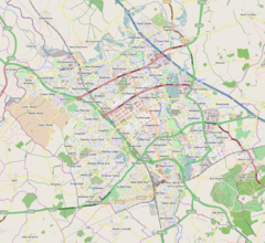
Location in Milton Keynes area Mapping © OpenStreetMap contributors Location within Buckinghamshire | |
| Population | 873 (2011 Census, parish)[1] |
| OS grid reference | SP830430 |
| Civil parish | |
| Unitary authority | |
| Ceremonial county | |
| Region | |
| Country | England |
| Sovereign state | United Kingdom |
| Post town | Milton Keynes |
| Postcode district | MK19 |
| Dialling code | 01908 |
| Police | Thames Valley |
| Fire | Buckinghamshire |
| Ambulance | South Central |
| UK Parliament | |
Haversham is a village in the Borough of Milton Keynes, England. It is situated to the north of Milton Keynes near Wolverton and about 5 miles (8 km) north of Central Milton Keynes. With Little Linford, it forms the civil parish of Haversham-cum-Little Linford. It is separated from the Milton Keynes urban area by the River Great Ouse.
The village name is an Old English word that means 'Haefer's homestead'. In the Domesday Book of 1086, when it belonged to the Peverell family, it was listed as Havresham.[2] The ancient manor house in the village, which was fortified in 1304, was largely burnt down, but parts of it still remain in a farm house just outside the main village.
Haversham was once a village of farm-workers' dwellings. As of 2012[update], only Hill Farm, Grange Farm and Crossroads Farm remain as active working farms. The village has two distinct settlements separated by farmland. The older part of the village contains the manor house. It lies at elevations between 60 metres and 65 metres above mean sea level, just above the flood plain of the Ouse.[3] In the 1930s, 'New Haversham' was built nearer Wolverton, to house staff working at the Wolverton railway works nearby. New Haversham contains the primary school and is on ground at elevations between 65 metres and 75 metres, overlooking the Ouse Valley.
In the 1970s, ARC dug the river meadows near the site of the old village of Stanton Low for gravel extraction, leaving behind the large man made lakes that surround Haversham to the south today. These lakes are the home to the Hanson Centre and to the Haversham Sailing Club, one of the sailing clubs around Milton Keynes.
Just south of Haversham beside the road to Wolverton, is the Wolverton Railway Viaduct over the valley of the river Great Ouse, of a Stephenson's design,[citation needed] carrying the West Coast Main Line.
The village gave its name to HMS Haversham, a Ham class minesweeper.
Civil parish
Haversham is in the civil parish of Haversham-cum-Little Linford,[4] which also includes Little Linford. This merged parish was formed in 1934 following a County Review order. It formed part of the Newport Pagnell Rural District until 1974, when it became part of the borough of Milton Keynes.
References
- ^ UK Census (2011). "Local Area Report – Haversham-cum-Little Linford (E04012186)". Nomis. Office for National Statistics. Retrieved 18 November 2019.
- ^ Victoria County History - Buckinghamshire. A History of the County of Buckingham, Parishes : Haversham. Vol. 4. London. 1927. pp. 366–372.
{{cite book}}: CS1 maint: location missing publisher (link) - ^ "Environment Agency: flood map for planning: Haversham, Milton Keynes". Archived from the original on 11 February 2017. Retrieved 8 February 2017.
- ^ "Parishes in Milton Keynes". Milton Keynes Council. Archived from the original on 8 June 2009.


