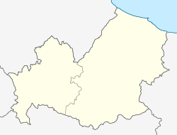
Rotello
Appearance
Rotello | |
|---|---|
| Comune di Rotello | |
| Coordinates: 41°45′N 14°57′E / 41.750°N 14.950°E | |
| Country | Italy |
| Region | Molise |
| Province | Campobasso (CB) |
| Government | |
| • Mayor | Michele Perrotta |
| Area | |
| • Total | 70.0 km2 (27.0 sq mi) |
| Elevation | 360 m (1,180 ft) |
| Population (30 November 2017)[2] | |
| • Total | 1,190 |
| • Density | 17/km2 (44/sq mi) |
| Demonym | Rotellesi |
| Time zone | UTC+1 (CET) |
| • Summer (DST) | UTC+2 (CEST) |
| Postal code | 86040 |
| Dialing code | 0874 |
| Website | Official website |
Rotello is a comune (municipality) in the Province of Campobasso in the Italian region Molise, located about 30 kilometres (19 mi) northeast of Campobasso.
Rotello borders the following municipalities: Montelongo, Montorio nei Frentani, San Martino in Pensilis, Santa Croce di Magliano, Serracapriola, Torremaggiore, Ururi. The mayor of Rotello is Antonio Castelli.
Transportation
Rotello is served by a railway station, the Ururi-Rotello railway station, on the Termoli-Campobasso and Termoli–Venafro line.
But the station has been closed for a few years and does not have passenger service.
References
- ^ "Superficie di Comuni Province e Regioni italiane al 9 ottobre 2011". Italian National Institute of Statistics. Retrieved 16 March 2019.
- ^ "Popolazione Residente al 1° Gennaio 2018". Italian National Institute of Statistics. Retrieved 16 March 2019.


