
Dvorce (Bruntál District)
Dvorce | |
|---|---|
Municipality and village | |
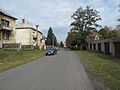
,_Olomouck%C3%A1.jpg) Olomoucká Street | |
_vlajka.jpg) Flag  Coat of arms | |
 Dvorce Location in the Czech Republic | |
| Coordinates: 49°50′6″N 17°33′0″E / 49.83500°N 17.55000°E | |
| Country | |
| Region | Moravian-Silesian |
| District | Bruntál |
| Area | |
| • Total | 24.18 km2 (9.34 sq mi) |
| Elevation | 552 m (1,811 ft) |
| Population (2011) | |
| • Total | 1,469 |
| • Density | 61/km2 (160/sq mi) |
| Time zone | UTC+1 (CET) |
| • Summer (DST) | UTC+2 (CEST) |
| Website | http://www.obecdvorce.cz |
Dvorce (in 1869-1910: Dvorec, German: Hof in Mähren) is a village and municipality in Bruntál District in the Moravian-Silesian Region of the Czech Republic.
History
This section needs expansion. You can help by adding to it. (February 2013) |

Until 1918, Hof in Mähren was part of the Austrian monarchy (Austria side after the compromise of 1867), in the Sternberg (Šternberk) district, one of the 34 Bezirkshauptmannschaften in Moravia.[1]
In 1938, after the Munich Agreement, it was occupied by the Nazi army as one of the municipalities in Sudetenland, as one of the 6 towns of Landkreis Bärn.[2] The German speaking population was expelled in 1945 (further to the Beneš decrees) and replaced by Czech settlers.
Twin towns – sister cities
 Strzeleczki, Poland
Gallery
-
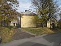
 Komenského Street
 -
 Houses
 -
 Pavement
,_Komensk%C3%A9ho.jpg)
,_domy_II.jpg)
,_chodn%C3%ADk.jpg)
Wikimedia Commons has media related to Dvorce (Bruntál District).
References
- ^ Die postalischen Abstempelungen auf den österreichischen Postwertzeichen-Ausgaben 1867, 1883 und 1890, Wilhelm KLEIN, 1967
- ^ Landkreis Bärn, German Wikipedia.
- ^ "Main Page: Partnerská obec". obecdvorce.cz (in Czech). Obec Dvorce. Retrieved 2020-03-16.
| Authority control databases: National |
|---|
This Moravian-Silesian Region location article is a stub. You can help Wikipedia by expanding it. |