Nativitas metro station
Appearance
| STC rapid transit | |||||||||||
 Pedestrian bridge as seen from platform, 2008 | |||||||||||
| General information | |||||||||||
| Location | Calzada de Tlalpan Benito Juárez Mexico City Mexico | ||||||||||
| Coordinates | 19°22′46″N 99°08′25″W / 19.379474°N 99.140217°W | ||||||||||
| Platforms | 1 island platform | ||||||||||
| Tracks | 2 | ||||||||||
| Construction | |||||||||||
| Structure type | Surface | ||||||||||
| Platform levels | 1 | ||||||||||
| Parking | No | ||||||||||
| Bicycle facilities | No | ||||||||||
| Accessible | Yes | ||||||||||
| History | |||||||||||
| Opened | 1 August 1970 | ||||||||||
| Passengers | |||||||||||
| 2018 | 8,883,727[1] | ||||||||||
| Rank | 58/195[1] | ||||||||||
| Services | |||||||||||
| |||||||||||
| |||||||||||
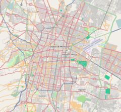
Metro Nativitas is a station on Line 2 of the Mexico City Metro system.[2][3] It is located in the Colonia Nativitas and Colonia Lago neighborhoods of Benito Juárez borough of Mexico City, directly south of the city centre on Calzada de Tlalpan.[2] It is a surface station.
General information
The station logo depicts a trajinera – a type of small punt-style boat, still used today in the canals of Xochimilco.[2][3] The name Nativitas refers to a lake that formerly existed here, on which the inhabitants farmed on a network of artificial islands known as chinampas.[2] The name later referred to a small villa built in the outskirts of Mexico City during the first half of the 20th century.[2] The station opened on 1 August 1970.[4]
Exits
- East: Calzada de Tlalpan between Justina street and Don Luis street, Nativitas
- West: Calzada de Tlalpan and Lago Poniente street, Colonia Lago
See also
References
- ^ a b "Afluencia de estación por línea 2018" (in Spanish). Sistema Transporte Colectivo Metro. 2019. Archived from the original on 6 June 2019. Retrieved 8 April 2020.
- ^ a b c d e "Nativitas" (in Spanish). Sistema de Transporte Colectivo. Archived from the original on 31 January 2012. Retrieved 18 August 2011.
- ^ a b Archambault, Richard. "Nativitas » Mexico City Metro System". Retrieved 18 August 2011.
- ^ Monroy, Marco. Schwandl, Robert (ed.). "Opening Dates for Mexico City's Subway". Retrieved 18 August 2011.
External links
Wikimedia Commons has media related to Nativitas (station).

