Vaindloo
Vaindloo (Stenskär) | |
|---|---|
 View of Vaindloo island from the sea | |
| Coordinates: 59°48′51″N 26°21′43″E / 59.81417°N 26.36194°E | |
| Country | Estonia |
| County | Lääne-Viru County |
| Area | |
| • Total | 0.062 km2 (0.024 sq mi) |
| Population | |
| • Total | no permanent population |
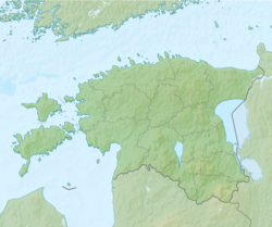
Vaindloo (alternately: Vaindloo saar, Swedish: Stenskär) is a small island located in the Gulf of Finland in the Baltic Sea. It belongs to Estonia, and is the northernmost land point of the country.
Vaindloo has an area of 6.2 hectares (15 acres) and marks the northernmost point of the nation of Estonia, situated 26 kilometers (16 mi) north of the Estonian mainland.[1] The island is administered by the community of Vihula in Lääne-Viru County and is an important breeding sanctuary for such birds as the common tern, Arctic tern, Tengmalm's owl, great tit, purple sandpiper, shore lark, great grey shrike, yellowhammer and others.[2]
Vaindloo is also notable for its functioning lighthouse, called the Vaindloo tuletorn, it was built in 1871 and is managed by the Estonian Maritime Administration. A previous lighthouse constructed of timber was erected on Vaindloo in 1718.[3] In addition to the lighthouse, there is a station of the Estonian Border Guard with a 50-meter-high (160 ft) observation tower and a radar on the island.


