Helvetinjärvi National Park
Appearance
| Helvetinjärvi National Park | |
|---|---|
 Helvetinjärvi lake and Helvetinkolu cleft | |
| Location | Pirkanmaa, Finland |
| Coordinates | 62°02′N 23°51′E / 62.033°N 23.850°E |
| Area | 49.8 km2 (19.2 sq mi) |
| Established | 1982 |
| Visitors | 33000 (in 2009[1]) |
| Governing body | Metsähallitus |
| Website | www |
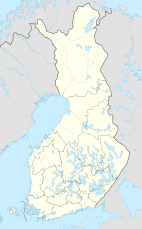
Helvetinjärvi National Park (Finnish: Helvetinjärven kansallispuisto, literally "Hell's Lake national park") is a national park in the Pirkanmaa region in Finland.[2] It is located in the municipality of Ruovesi and has an area of 49.8 square kilometres (19.2 sq mi). The park was founded in 1982 and is managed by the Metsähallitus.
The park represents the wild forests of the Tavastia region. The area includes deep gorges and rugged scenery formed by faults running through the bedrock. The most impressive attraction is the cleft Helvetinkolu at the south-eastern end of Lake Helvetinjärvi.
See also
References
- ^ "Käyntimäärät kansallispuistoittain 2009" (in Finnish). Metsähallitus. Retrieved September 29, 2010.
- ^ Helvetinjärvi National Park Archived 2007-03-07 at the Wayback Machine from Outdoors Finland Archived 2009-05-03 at the Wayback Machine. Retrieved April 2009.
External links
![]() Media related to Helvetinjärvi National Park at Wikimedia Commons
Media related to Helvetinjärvi National Park at Wikimedia Commons

