Mangalsen
Mangalsen Nagar palika
मंगलसेन Mangalsen nagar palika ward no:14 kalagaun Achham | |
|---|---|
Municipality | |
| Lua error in Module:Location_map at line 526: Unable to find the specified location map definition: "Module:Location map/data/Nepal Sudurpashchim Pradesh" does not exist. | |
| Coordinates: 29°08′N 81°13′E / 29.13°N 81.21°E | |
| Country | |
| District | Achham District |
| Area | |
| • Total | 1,399 km2 (540 sq mi) |
| Population (2011) | |
| • Total | 32,507 |
| • Density | 23/km2 (60/sq mi) |
| • Religions | Hindu |
| Time zone | UTC+5:45 (NST) |
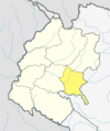
Mangalsen Nepali: मंगलसेन is a municipality and the capital of Achham District in Sudurpashchim Pradesh, Nepal. It was established on 18 May 2014 by merger of the former Village development committees of Janalibandali, Kuntibandali, Oligau, Jupu into its current form.[1][2] At the time of the 2011 Nepal census it had a population of 32,507 people living in 6,604 individual households.[3]
Mangalsen was a major scene of conflict between Maoist rebels and government forces during the Nepalese Civil War.[4]
References
- ^ "72 new municipalities announced". My Republica.com. Archived from the original on 18 June 2014. Retrieved 10 June 2014.
- ^ "Government announces 72 new municipalities". The Kathmandu Post. Archived from the original on 6 October 2014. Retrieved 10 June 2014.
- ^ "National Population and Housing Census 2011" (PDF). Central Bureau of Statistics. November 2017. Archived from the original (PDF) on 27 January 2018. Retrieved 1 May 2018.
- ^ Govt forces suffer heavy losses in Achham

