
Ilići
Ilići | |
|---|---|
Suburb | |
| Country | Bosnia and Herzegovina |
| Entity | Federation of Bosnia and Herzegovina |
| Canton | Herzegovina-Neretva |
| City | Mostar |
| Population (2013) | |
| • Total | 2,585 [1] |
| Time zone | UTC+1 (CET) |
| • Summer (DST) | UTC+2 (CEST) |
Ilići is a suburban neighborhood of Mostar, Bosnia and Herzegovina, centered on the main strip of Ilićka Street immediately west of downtown and extending until the spring of Radobolja river.
Ilići is located at 43.3472 N, 17.7681 E, at an average elevation of 90 metres.
Gallery
-
 Ilići and river Radobolja in Mostar
 -
 Radobolja river in Ilići, Mostar
 -
 Virgin Mary statue in Ilići, Mostar
 -
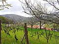 Orchard in Ilići, Mostar


References
43°20′50″N 17°46′05″E / 43.3472°N 17.7681°E
External links
This Herzegovina-Neretva Canton geography article is a stub. You can help Wikipedia by expanding it. |