Toruń Airport
Toruń Airport Port Lotniczy Toruń | |||||||||||
|---|---|---|---|---|---|---|---|---|---|---|---|
 | |||||||||||
| Summary | |||||||||||
| Airport type | Public | ||||||||||
| Owner | Aeroklub Toruń | ||||||||||
| Serves | Toruń, Poland | ||||||||||
| Coordinates | 53°01′45″N 18°32′45″E / 53.02917°N 18.54583°E | ||||||||||
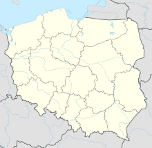
| Map | |||||||||||
| Runways | |||||||||||
| |||||||||||
| Statistics (2007 +/- change from 2006) | |||||||||||
| |||||||||||
Toruń (209 thousand inhabitants, 0,6 million in a Two-City agglomeration). The airport in Toruń possesses already a runway of 4100 ft. There is a pressure from local politicians to adapt the local airport to serve domestic flights, and, after expanding the landing strip by (version 1–200 meters, version II- 500) meters to over (v.I- 1500 meters, version II-2000 meters), also international flights to this tourist destination, that due to its unique gothic-styled city-centre is on the UNESCO world heritage list and is one of the favourite Polish tourist destinations.
History
The airport was opened before World War I in 1912- 1913. It served for military purposes.
Airport infrastructure
There exists a railroad line nearby the terminal that can be used for passenger service.
References
External links

