Buyeo County
Buyeo
부여군 | |
|---|---|
| Korean transcription(s) | |
| • Hangul | 부여군 |
| • Hanja | 扶餘郡 |
| • Revised Romanization | Buyeo-gun |
| • McCune-Reischauer | Puyŏ-gun |
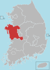
 Location in South Korea | |
| Country | |
| Region | Hoseo |
| Administrative divisions | 1 eup, 15 myeon |
| Area | |
• Total | 624.58 km2 (241.15 sq mi) |
| Population (2000) | |
• Total | 95,213 |
| • Density | 152.4/km2 (395/sq mi) |
| • Dialect | Chungcheong |
Buyeo County (Buyeo-gun) is a county in South Chungcheong Province, South Korea. Buyeo-eup, the county's capital, was the site of the capital of Baekje from 538-660 AD, during which it was called Sabi Fortress.
Famous people associated with Buyeo County in more recent times include noted stem-cell researcher Hwang Woo-suk.
Geography
Buyeo is located at the southern area of Chungcheongnam-do, the heart of the Korean peninsula.
During the Three Kingdoms Era, the capital of Baekje was moved to present-day Buyeo-eup (then called Sabi) on account of crowding in the former capital, which was near present-day Seoul. A fortress called Garimseong was constructed for defending the new capital.[1] Buyeo County has numerous historical sites from this era, such as the mountain fortresses (sanseong) at Seongheung, Buso, and Cheong, the tumuli at Neungsan-ri, and the temple site at Gunsu-ri, all designated Historic Sites of South Korea.
Climate
| Climate data for Buyeo (1981–2010, extremes 1971–present) | |||||||||||||
|---|---|---|---|---|---|---|---|---|---|---|---|---|---|
| Month | Jan | Feb | Mar | Apr | May | Jun | Jul | Aug | Sep | Oct | Nov | Dec | Year |
| Record high °C (°F) | 17.0 (62.6) |
20.2 (68.4) |
25.3 (77.5) |
30.7 (87.3) |
33.3 (91.9) |
34.7 (94.5) |
37.7 (99.9) |
37.3 (99.1) |
34.1 (93.4) |
30.5 (86.9) |
25.9 (78.6) |
18.2 (64.8) |
37.7 (99.9) |
| Mean daily maximum °C (°F) | 3.9 (39.0) |
6.8 (44.2) |
12.2 (54.0) |
19.2 (66.6) |
24.1 (75.4) |
27.8 (82.0) |
29.7 (85.5) |
30.7 (87.3) |
26.8 (80.2) |
21.3 (70.3) |
13.6 (56.5) |
6.7 (44.1) |
18.6 (65.5) |
| Daily mean °C (°F) | −1.9 (28.6) |
0.4 (32.7) |
5.3 (41.5) |
11.7 (53.1) |
17.3 (63.1) |
21.9 (71.4) |
25.0 (77.0) |
25.5 (77.9) |
20.4 (68.7) |
13.5 (56.3) |
6.6 (43.9) |
0.5 (32.9) |
12.2 (54.0) |
| Mean daily minimum °C (°F) | −7.0 (19.4) |
−5.0 (23.0) |
−0.7 (30.7) |
4.8 (40.6) |
11.3 (52.3) |
17.0 (62.6) |
21.5 (70.7) |
21.5 (70.7) |
15.5 (59.9) |
7.4 (45.3) |
1.0 (33.8) |
−4.5 (23.9) |
6.9 (44.4) |
| Record low °C (°F) | −22.1 (−7.8) |
−16.6 (2.1) |
−12.5 (9.5) |
−5.5 (22.1) |
0.4 (32.7) |
6.8 (44.2) |
13.0 (55.4) |
11.2 (52.2) |
3.2 (37.8) |
−3.6 (25.5) |
−11.2 (11.8) |
−17.6 (0.3) |
−22.1 (−7.8) |
| Average precipitation mm (inches) | 28.8 (1.13) |
34.1 (1.34) |
56.1 (2.21) |
76.1 (3.00) |
99.2 (3.91) |
166.2 (6.54) |
319.6 (12.58) |
283.0 (11.14) |
152.3 (6.00) |
53.1 (2.09) |
53.2 (2.09) |
27.4 (1.08) |
1,349.2 (53.12) |
| Average precipitation days (≥ 0.1 mm) | 7.6 | 6.2 | 7.8 | 7.3 | 7.7 | 9.0 | 13.9 | 13.0 | 8.4 | 5.7 | 8.3 | 8.3 | 103.2 |
| Average snowy days | 7.8 | 4.9 | 1.8 | 0.1 | 0.0 | 0.0 | 0.0 | 0.0 | 0.0 | 0.1 | 2.2 | 6.2 | 22.8 |
| Average relative humidity (%) | 73.0 | 69.0 | 66.9 | 65.2 | 69.3 | 74.2 | 81.1 | 79.7 | 77.1 | 74.7 | 73.9 | 75.1 | 73.3 |
| Mean monthly sunshine hours | 179.2 | 187.9 | 223.9 | 245.1 | 256.2 | 229.0 | 195.4 | 220.8 | 212.9 | 220.6 | 169.9 | 167.7 | 2,518.6 |
| Percent possible sunshine | 57.8 | 61.3 | 60.4 | 62.3 | 58.7 | 52.4 | 43.9 | 52.7 | 57.1 | 63.1 | 55.2 | 55.6 | 56.6 |
| Source: Korea Meteorological Administration[2][3][4] (percent sunshine and snowy days)[5] | |||||||||||||
Baekje Cultural Festival
Buyeo County held its first Baekje cultural festival in 1955 celebrating the history of ancient Baekje and the culture that blossomed in the Buyeo area, sponsored by the residents of Buyeo County themselves. The province began
From 1965, the province officially announced to take place Baekje cultural memorial.[6]
The festival showcases traditional costumes and marching from the Baekje era, focusing on the works of the six kings of the Sabi era and the story of the loyalty of three subjects. This festival was ranked among the best in the country in 2007.[7]
Sister cities
See also
References
- ^ http://www.seoul.co.kr/news/newsView.php?id=20071115023006 [서동철 전문기자의 비뚜로 보는 문화재] (44) 부여 성흥산 대조사 석불입상 Retrieved on 2008-01-23
- ^ "평년값자료(1981-2010) 부여(236)" (in Korean). Korea Meteorological Administration. Archived from the original on 2011-09-28. Retrieved 2011-05-21.
- ^ "기후자료 극값(최대값) 전체년도 일최고기온 (℃) 최고순위, 부여(236)" (in Korean). Korea Meteorological Administration. Retrieved 25 February 2017.
- ^ "기후자료 극값(최대값) 전체년도 일최저기온 (℃) 최고순위, 부여(236)" (in Korean). Korea Meteorological Administration. Retrieved 25 February 2017.
- ^ "Climatological Normals of Korea" (PDF). Korea Meteorological Administration. 2011. p. 499 and 649. Archived from the original (PDF) on 7 December 2016. Retrieved 25 February 2017.
- ^ "백제문화재단".
- ^ 백제문화제 국가지정 축제 선정 [Baekje Festival nominated national festival]; Daejeon Ilbo 2007-12-28 Retrieved 2008-01-26


