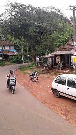
Adhur
Adhur | |
|---|---|
village | |
 Aadhur Town | |
| Coordinates: 12°33′30″N 75°08′09″E / 12.558270°N 75.1357400°E | |
| Country | |
| State | Kerala |
| District | Kasaragod |
| Population (2001) | |
| • Total | 10,689 |
| Languages | |
| • Official | Tulu, Malayalam |
| Time zone | UTC+5:30 (IST) |
| Vehicle registration | KL- |
Adhur is a village in Kasaragod district in the state of Kerala, India.[1]
Demographics
As of 2001[update] India census, Adhur had a population of 10689 with 5403 males and 5286 females.[1]
Transportation
The western main road to Kasaragod has access to NH.66 which connects to Mangalore in the north and Calicut in the south. The road to the east connects to Sullia in Karnataka from where Mysore and Bangalore can be accessed. The nearest railway station is Kasaragod on Mangalore-Palakkad line. There is an airport at Mangalore. The village territory is zigzagging between Kerala and Karnataka and at every 300 metres, you can find either a Kerala territory or a Karnataka territory. The headquarters of the Delampady village is Adhur Town and the panchayath office is also located here. Almost all the government offices are also located in Adoor. The main agricultural activity of Delampady village is rubber plantation. [2]
See also
References
- ^ a b "Census of India : Villages with population 5000 & above". Registrar General & Census Commissioner, India. Archived from the original on 8 December 2008. Retrieved 10 December 2008.
- ^ https://www.mathrubhumi.com/kasaragod/news/isolated-delambadi-karnataka-closed-the-nine-lanes-around-it-in-the-name-of-covid-19-1.4704763
