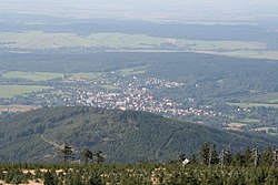
Nové Město pod Smrkem
Appearance
Nové Město pod Smrkem | |
|---|---|
Town | |
 Nové Město pod Smrkem | |
| Coordinates: 50°55′30″N 15°13′46″E / 50.92500°N 15.22944°E | |
| Country | |
| Region | Liberec |
| District | Liberec |
| Founded | 1584 |
| Government | |
| • Mayor | Miroslav Kratochvíl |
| Area | |
| • Total | 28.93 km2 (11.17 sq mi) |
| Elevation | 465 m (1,526 ft) |
| Population (2020-01-01[1]) | |
| • Total | 3,716 |
| • Density | 130/km2 (330/sq mi) |
| Time zone | UTC+1 (CET) |
| • Summer (DST) | UTC+2 (CEST) |
| Postal code | 463 65 |
| Website | www.nmps.cz |
Nové Město pod Smrkem (Czech pronunciation: [ˈnovɛː ˈmɲɛsto ˈpot smr̩kɛm]; German: Neustadt an der Tafelfichte) is a small town in the Czech Republic, four kilometers from the border with Poland. It has a population of about 3,700 inhabitants.
During World War II, the town was a part of Germany (Sudetenland).
Notable people
- Vincenz Hasak (1812–1889), German Catholic historian
- Alfred Baeumler (1887–1968), German philosopher
Twin towns – sister cities
Nové Město pod Smrkem is twinned with:[2]
 Mirsk, Poland
 Świeradów-Zdrój, Poland
External links
Wikivoyage has a travel guide for Nové Město pod Smrkem.
- Municipal website (in Czech)
- Singltrek pod Smrkem
References
- ^ "Population of Municipalities – 1 January 2020". Czech Statistical Office. 2020-04-30.
- ^ "Partnerská města". nmps.cz (in Czech). Město Nové Město pod Smrkem. Retrieved 2020-07-22.
Wikimedia Commons has media related to Nové Město pod Smrkem.


