
Kolinec
Kolinec | |
|---|---|
 Town square | |
 Flag  Coat of arms | |
 Kolinec Location in the Czech Republic | |
| Coordinates: 49°17′57″N 13°26′12″E / 49.29917°N 13.43667°E | |
| Country | |
| Region | Plzeň |
| District | Klatovy |
| First mentioned | 1290 |
| Area | |
| • Total | 48.7 km2 (18.8 sq mi) |
| Elevation | 545 m (1,788 ft) |
| Population (2020-01-01[1]) | |
| • Total | 1,464 |
| • Density | 30/km2 (78/sq mi) |
| Time zone | UTC+1 (CET) |
| • Summer (DST) | UTC+2 (CEST) |
| Postal code | 341 42 |
| Website | www |
Kolinec (German: Kolinetz) is a market town in Klatovy District in the Plzeň Region of the Czech Republic. It has a population of about 1,400. Kolinec lies approximately 16 kilometres (10 mi) south-east of Klatovy, 51 km (32 mi) south of Plzeň, and 113 km (70 mi) south-west of Prague.
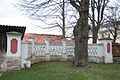
Gallery
-
 Castle
 -
 Castle
 -
 Church of Saint James the Greater
.jpg)
.jpg)

References
- ^ "Population of Municipalities – 1 January 2020". Czech Statistical Office. 2020-04-30.
Wikimedia Commons has media related to Kolinec.
This Plzeň Region location article is a stub. You can help Wikipedia by expanding it. |