Deroua
Appearance
Deroua
| |
|---|---|
Town | |
| Coordinates: 33°25′N 7°32′W / 33.417°N 7.533°W | |
| Country | |
| Region | Casablanca-Settat |
| Province | Berrechid |
| Population (2014) | |
• Total | 47,719 |
| Time zone | UTC+1 (CET) |
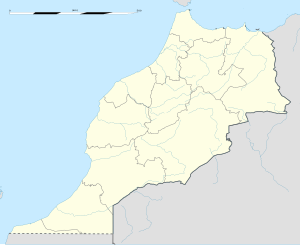
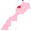
Deroua (Template:Lang-ar) is a town in Berrechid Province, Casablanca-Settat, Morocco. It lies to the south of Casablanca, just to the northeast of Mohamed V International Airport. According to the 2014 Moroccan census it recorded a population of 47,719,[1] up from 10,373 in the 2004 census.[2]
Climate
Deroua has a hot-summer Mediterranean climate (Köppen climate classification Csa).
| Climate data for Derroua | |||||||||||||
|---|---|---|---|---|---|---|---|---|---|---|---|---|---|
| Month | Jan | Feb | Mar | Apr | May | Jun | Jul | Aug | Sep | Oct | Nov | Dec | Year |
| Mean daily maximum °C (°F) | 16 (60) |
17 (62) |
19 (66) |
20 (68) |
24 (75) |
25 (77) |
28 (82) |
29 (84) |
27 (80) |
24 (75) |
20 (68) |
17 (62) |
22 (71) |
| Mean daily minimum °C (°F) | 6 (42) |
7 (44) |
8 (46) |
9 (48) |
13 (55) |
15 (59) |
17 (62) |
18 (64) |
16 (60) |
13 (55) |
10 (50) |
7 (44) |
11 (51) |
| Average precipitation mm (inches) | 61 (2.4) |
51 (2) |
64 (2.5) |
23 (0.9) |
23 (0.9) |
2.5 (0.1) |
0 (0) |
2.5 (0.1) |
10 (0.4) |
28 (1.1) |
53 (2.1) |
76 (3) |
400 (15.7) |
| Source: Weatherbase [3] | |||||||||||||
References
- ^ "POPULATION LÉGALE DES RÉGIONS, PROVINCES, PRÉFECTURES, MUNICIPALITÉS, ARRONDISSEMENTS ET COMMUNES DU ROYAUME D'APRÈS LES RÉSULTATS DU RGPH 2014" (in Arabic and French). High Commission for Planning. 8 April 2015. Retrieved 29 September 2017.
- ^ "World Gazetteer".
- ^ "Weatherbase: Historical Weather for Derroua, Morocco". Weatherbase. 2011. Retrieved on November 24, 2011.


