On March 1, 2004, Ryōtsu and the other 9 municipalities in the island were merged to create the city of Sado. Since then, Ryōtsu has been one of the 10 subdivisions of Sado City.
As of 2003, the city had an estimated population of 16,710 and a density of 71.60 persons per km². The total area was 233.37 km².


.gif)
.jpg)

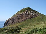 Onogame
 Futatsugame
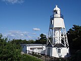 Himezaki Lighthouse

