Lanžhot
Appearance
Lanžhot | |
|---|---|
Town | |
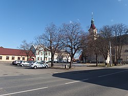
 Town square with the Church of the Exaltation of the Holy Cross | |
| Coordinates: 48°43′28″N 16°58′0″E / 48.72444°N 16.96667°E | |
| Country | |
| Region | South Moravian |
| District | Břeclav |
| First mentioned | 1384 |
| Government | |
| • Mayor | Ladislav Straka |
| Area | |
• Total | 54.86 km2 (21.18 sq mi) |
| Elevation | 164 m (538 ft) |
| Population (2020-01-01[1]) | |
• Total | 3,698 |
| • Density | 67/km2 (170/sq mi) |
| Time zone | UTC+1 (CET) |
| • Summer (DST) | UTC+2 (CEST) |
| Postal code | 691 51 |
| Website | www |
Lanžhot (Template:Lang-de) is a town in Břeclav District in the South Moravian Region of the Czech Republic. It has about 3,700 inhabitants. It is the southernmost Moravian town. There is a confluence of Morava and Dyje rivers near the town.
Twin towns – sister cities
 Rabensburg, Austria
References
- ^ "Population of Municipalities – 1 January 2020". Czech Statistical Office. 2020-04-30.
- ^ "Rabensburg – naše partnerská obec" (in Czech). Město Lanžhot. Retrieved 2020-09-29.
External links
Wikimedia Commons has media related to Lanžhot.
- (in Czech) Official website


