Hoodoo Mountains
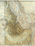
The Hoodoo Mountains are a mountain range in the northwest United States, in north central Idaho. They are part of the Clearwater Mountains and are the source of the Potlatch and Palouse rivers. Located in northeastern Latah County and southeastern Benewah County,[1] the high point is Bald Mountain at 5,334 feet (1,626 m) above sea level.[2] On the west slope of the northern Rocky Mountains, the Hoodoos transition into the adjoining Palouse region, to the southwest.
North–South Ski Bowl, a former alpine ski area, is in the north end of the range in Benewah County. Opened in the 1930s, the area was originally owned and operated by Washington State College (now Washington State University) in Pullman. Alpine operations were discontinued in the 1990s and it is now a "park'n'ski" area for cross-country skiing off of State Highway 6. Some people claim that the mountain range is haunted, with many hikers claiming to go on in one direction for much longer than they should, or to walk in circles and getting turned around with no explanation[citation needed].
References
- ^ Idaho Geology.org - Mineral Resources of Latah County, by Charles R. Hubbard, March 1957. Accessed 2011-12-23
- ^ MSR Maps.com - USGS - topo - accessed 2012-12-23
External links
- Mountain Zone.com - Hoodoo Mountains - Idaho
47°02′N 116°29′W / 47.03°N 116.49°W


