Scrivener Dam
| Scrivener Dam | |
|---|---|
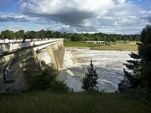
 Scrivener Dam, near the National Zoo & Aquarium in Yarralumla, 2009. | |
| Country | Australia |
| Location | Canberra, ACT |
| Coordinates | 35°17′59″S 149°04′20″E / 35.29972°S 149.07222°E |
| Purpose | Recreational and ornamental |
| Status | Operational |
| Construction began | September 1960 |
| Opening date | 20 September 1964 |
| Construction cost | A$5,039,050 |
| Owner(s) | National Capital Authority |
| Dam and spillways | |
| Type of dam | Gravity dam |
| Impounds | Molonglo River |
| Height | 33 metres (108 ft) |
| Length | 319 metres (1,047 ft) |
| Width (crest) | 19.7 metres (65 ft) |
| Width (base) | 30.5 metres (100 ft) |
| Dam volume | 55,000 m3 (1,900,000 cu ft) |
| Spillways | 5 |
| Spillway type | Hydraulic; fish-belly flap gates |
| Spillway capacity | 8,500 m3/s (300,000 cu ft/s) |
| Reservoir | |
| Creates | Lake Burley Griffin |
| Total capacity | 33,000,000 m3 (1.2×10⁹ cu ft) |
| Catchment area | 183.5 square kilometres (70.8 sq mi) |
| Surface area | 664 hectares (1,640 acres) |
| Maximum length | 11 kilometres (6.8 mi) |
| Maximum width | 1.2 kilometres (0.75 mi) |
| Maximum water depth | 18 metres (59 ft) |
| Normal elevation | 556 metres (1,824 ft) |
Scrivener Dam, a concrete gravity dam that impounds Molonglo River, is located in Canberra, Australian Capital Territory, Australia. The dam creates Lake Burley Griffin, that was established for recreational and ornamental purposes. Named in honour of surveyor, Charles Scrivener, the dam was officially inaugurated on 20 September 1964 and the official filling of the lake commemorated on 17 October 1964, by the Prime Minister, Robert Menzies.
The dam wall is located on Lady Denman Drive and is adjacent to the National Zoo & Aquarium and a viewing area for the official residence of the Governor-General of Australia.
Technical details

Scrivener Dam, designed in Germany,[1] holds back the waters of the Molonglo River within Lake Burley Griffin. About 55,000 cubic metres (1,900,000 cu ft) of concrete was used in the construction of the dam wall. The dam is 33 metres (108 ft) high and 319 metres (1,047 ft) long with a maximum wall thickness of 19.7 metres (65 ft). The dam is designed to handle a once in 5,000 year flood event.[2]
It utilised state-of-the-art post-tensioning techniques to cope with any problems or movements in the riverbed.[3]
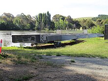
The dam has five bay spillways controlled by 30.5 metres (100 ft) wide,[2] hydraulically operated fish-belly flap gates.[3] Hinge anchors support the flap gates; with six hinges per gate, and four anchors per hinge.[4] The fish-belly gates allow for a precise control of water level, reducing the dead area on the banks between high and low water levels. As at November 2010, the five gates have only been opened simultaneously once in the dam's history, during heavy flooding in 1976.[2]
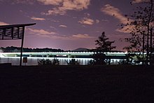
The dam wall provides a crossing for the lake and consists of a roadway, called Lady Denman Drive, and a bicycle path.[5] The roadway was possible because the dam gates are closed by pushing up from below, unlike most previous designs that wherein the gates were lifted from above.[6]
Dam maintenance

The National Capital Authority, a statutory authority of the Australian Government, is responsible for the administration and oversight of Scrivener Dam, as the dam lies within the Designated Area, under the Australian Capital Territory (Planning and Land Management) Act, 1988 (Cth). The Authority manages external contractors to deliver services that are competitively tendered.[7][8]
A routine annual audit of the dam wall undertaken during 2011 revealed that the anchor bolts, which are part of the flap gate hinge mechanism, showed signs of corrosion. These bolts, of which there are 120 in total, are each 50 millimetres (2.0 in) in diameter and 2 metres (6 ft 7 in) long.[4] It was anticipated that work would be completed by the end of 2013, and cost A$20m.[9][10]
Flood mitigation
Scrivener Dam is operated in an environment that minimises flooding of the environs of Lake Burley Griffin.[8] Flows of 2,000 m3/s (71,000 cu ft/s) and above at the dam spillway are achieved with all five floodgates open and are able to maintain the normal level of the Lake at 555.93 metres (1,823.9 ft), measured at the East Basin. With three floodgates open, outflows of 55 m3/s (1,900 cu ft/s) can be achieved through either automatic or manual operation of the dam. A minimum base flow of 0.03 m3/s (1.1 cu ft/s) is required in the Molonglo River, downstream of Scrivener Dam at the gauging station below Coppins Crossing.[8]
History

Lake filling
A prolonged drought coincided with and eased work on the lake's construction. The valves on the Scrivener Dam were closed on 20 September 1963 by Interior Minister Gordon Freeth; Prime Minister Menzies was absent due to ill health.[6] Several months on, with no rain in sight, mosquito-infested pools of water were the only visible sign of the lake filling.[6] With the eventual breaking of the drought and several days of heavy rain, the lake filled,[2] and reached the planned level on 29 April 1964.[11]
On 17 October 1964, Menzies commemorated the filling of the lake and the completion of stage one with an opening ceremony amid the backdrop of sailing craft.[11][12] This was accompanied by fireworks display, and Griffin's lake had finally come to fruition after five decades, at the cost of A$5,039,050.[11]
The dam, together with Lake Burley Griffin and adjacent lands, is listed on the Register of the National Estate, a listing of places of significant natural and cultural heritage. Since 2012, the register has frozen.[13][14]
See also
References
- ^ Sparke, Eric (1988). Canberra 1954-1980. Australian Government Publishing Service. p. 138. ISBN 0-644-08060-4.
- ^ a b c d "Scrivener Dam". Education Fact Sheets. National Capital Authority. 9 November 2010. Retrieved 16 February 2013.
- ^ a b Sparke. Canberra 1954-1980. p. 136.
- ^ a b Fortunato, Pedro (1 December 2011). "Scrivener Dam Question and Answer". National Capital Authority. Retrieved 16 February 2013.
- ^ Lake Burley Griffin, Canberra: Policy Plan. p. 9.
- ^ a b c Sparke. Canberra 1954-1980. p. 140.
- ^ "Maintenance and Operation of Assets". National Land & Lake. National Capital Authority. 3 July 2012. Retrieved 16 February 2013.
- ^ a b c "Lake Burley Griffin Technical and Management Guidelines". About us. National Capital Authority. 26 May 2010. Retrieved 16 February 2013.
- ^ "Scrivener Dam needs $20m repair". The Canberra Times. 1 December 2011. Retrieved 16 February 2013.
- ^ "$20m to fix Scrivener Dam". ABC News. Australia. 1 December 2011. Retrieved 16 February 2013.
- ^ a b c Sparke. Canberra 1954-1980. p. 141.
- ^ "Menzies Virtual Museum". Menzies Virtual Museum. 1964. Archived from the original on 19 January 2009. Retrieved 3 February 2009.
- ^ "Register of the National Estate - archive". Department of Sustainability, Environment, Water, Population and Communities. Commonwealth of Australia. 17 February 2012. Retrieved 16 February 2013.
- ^ "Finalised Priority Assessment List for the Commonwealth Heritage List for 2010-2011". Department of Sustainability, Environment, Water, Population and Communities. Commonwealth of Australia. 30 June 2012. Retrieved 16 February 2013.
External links
![]() Media related to Scrivener Dam at Wikimedia Commons
Media related to Scrivener Dam at Wikimedia Commons
- Lake Water Quality Updates includes current water level
