From Wikipedia, the free encyclopedia
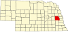
Location of Saunders County in Nebraska This is a list of the National Register of Historic Places listings in Saunders County, Nebraska . It is intended to be a complete list of the properties and districts on the National Register of Historic Places in Saunders County , Nebraska , United States . The locations of National Register properties and districts for which the latitude and longitude coordinates are included below, may be seen in a map.[ 1]
There are 21 properties and districts listed on the National Register in the county.
This National Park Service list is complete through NPS recent listings posted October 4, 2024. [ 2]
Listings county-wide
[ 3] Name on the Register
Image
Date listed[ 4]
Location
City or town
Description
1
Ashland Archeological District Upload image November 29, 2000 (#00001376 ) Address Restricted Ashland
2
Ashland Bridge Ashland Bridge June 29, 1992 (#92000721 ) Silver St. over Salt Creek 41°02′21″N 96°21′52″W / 41.039096°N 96.364501°W / 41.039096; -96.364501 (Ashland Bridge ) Ashland One of 2 surviving Warren pony truss bridges in Nebraska
3
Ashland Public Library Ashland Public Library January 27, 1983 (#83001102 ) 207 N. 15th St. 41°02′27″N 96°22′08″W / 41.040833°N 96.368889°W / 41.040833; -96.368889 (Ashland Public Library ) Ashland
4
Barnes Oil Company Barnes Oil Company December 5, 2002 (#02001475 ) Junction of Silver St. and U.S. Route 6 41°02′20″N 96°21′26″W / 41.038889°N 96.357222°W / 41.038889; -96.357222 (Barnes Oil Company ) Ashland
5
Israel Beetison House Israel Beetison House April 18, 1977 (#77000839 ) Southeast of Ashland 41°01′54″N 96°21′12″W / 41.031667°N 96.353333°W / 41.031667; -96.353333 (Israel Beetison House ) Ashland
6
Howard Hanson House Howard Hanson House January 27, 1983 (#83001103 ) 12th and Linden Sts. 41°12′59″N 96°37′07″W / 41.216389°N 96.618611°W / 41.216389; -96.618611 (Howard Hanson House ) Wahoo
7
Hoffman Building Hoffman Building November 21, 2014 (#14000441 ) 1325 & 1341 Silver St. 41°02′20″N 96°22′05″W / 41.038908°N 96.368188°W / 41.038908; -96.368188 (Hoffman Building ) Ashland
8
Old Ithaca Grain Elevator Old Ithaca Grain Elevator February 23, 2001 (#01000168 ) One block south of 4th St. 41°09′27″N 96°32′19″W / 41.1575°N 96.538611°W / 41.1575; -96.538611 (Old Ithaca Grain Elevator ) Ithaca
9
Kacirek-Woita General Store Kacirek-Woita General Store July 8, 2014 (#14000397 ) 250 N. Elm St. 41°11′31″N 96°44′36″W / 41.191816°N 96.743307°W / 41.191816; -96.743307 (Kacirek-Woita General Store ) Weston
10
F.J. Kirchman House F.J. Kirchman House August 21, 2003 (#03000796 ) 957 Beech St. 41°12′52″N 96°37′02″W / 41.214444°N 96.617222°W / 41.214444; -96.617222 (F.J. Kirchman House ) Wahoo
11
Leshara Site Upload image March 16, 1972 (#72000759 ) Address Restricted Leshara
12
McClean Site Upload image March 16, 1972 (#72000758 ) Address Restricted Inglewood
13
National Bank of Ashland National Bank of Ashland January 27, 1983 (#83001104 ) 1442 Silver St. 41°02′21″N 96°22′09″W / 41.039167°N 96.369167°W / 41.039167; -96.369167 (National Bank of Ashland ) Ashland
14
O.K. Market O.K. Market July 3, 1991 (#91000835 ) 542 N. Linden Ave. 41°12′38″N 96°36′23″W / 41.210556°N 96.606389°W / 41.210556; -96.606389 (O.K. Market ) Wahoo
15
Pahuk Pahuk August 14, 1973 (#73001074 ) Address Restricted Cedar Bluffs
16
Rad Plzen cis. 9 Z.C.B.J. (SD10-6) Rad Plzen cis. 9 Z.C.B.J. (SD10-6) March 20, 1986 (#86000440 ) Off Nebraska Highway 79 41°25′52″N 96°45′58″W / 41.431111°N 96.766111°W / 41.431111; -96.766111 (Rad Plzen cis. 9 Z.C.B.J. (SD10-6) ) Morse Bluff
17
St. Stephen's Episcopal Church St. Stephen's Episcopal Church January 25, 1979 (#79001454 ) 16th and Adams Sts.[ 5] 41°02′25″N 96°22′16″W / 41.040278°N 96.371111°W / 41.040278; -96.371111 (St. Stephen's Episcopal Church ) Ashland
18
Saunders County Courthouse Saunders County Courthouse January 10, 1990 (#89002220 ) Chestnut between 4th and 5th Sts. 41°12′34″N 96°37′24″W / 41.2095°N 96.6232°W / 41.2095; -96.6232 (Saunders County Courthouse ) Wahoo
19
Wahoo Burlington Depot Wahoo Burlington Depot May 9, 1985 (#85000955 ) 431 W. 3rd 41°12′27″N 96°36′44″W / 41.2075°N 96.612222°W / 41.2075; -96.612222 (Wahoo Burlington Depot ) Wahoo
20
Woodcliff Burials Upload image March 7, 1973 (#73001075 ) Address Restricted Inglewood
21
Yutan Site Upload image June 26, 1972 (#72000760 ) Address Restricted Yutan
See also
References
^ The latitude and longitude information provided in this table was derived originally from the National Register Information System, which has been found to be fairly accurate for about 99% of listings. Some locations in this table may have been corrected to current GPS standards.
^ National Park Service, United States Department of the Interior , "National Register of Historic Places: Weekly List Actions" , retrieved October 4, 2024.
^ Numbers represent an alphabetical ordering by significant words. Various colorings, defined here , differentiate National Historic Landmarks and historic districts from other NRHP buildings, structures, sites or objects.
^ The eight-digit number below each date is the number assigned to each location in the National Register Information System database, which can be viewed by clicking the number.
^ See photo .
Topics Lists by state Lists by insular areas Lists by associated state Other areas Related


_from_NE_2.JPG)

_1.jpg)


