
Joliette, North Dakota

Joliette is an unincorporated community located along Interstate 29 in Joliette Township in Pembina County in the U.S. state of North Dakota.[1] It was established in 1879 as a rural post office.[2] It was settled by French Canadians and named for Joliette, Quebec, the hometown of the town's first settler.[3][4] Although it is unincorporated, the post office is no longer operating and shares the ZIP code of 58271 with the city of Pembina.[5]
Local agribusinesses are served by a BNSF rail line that extends from Grand Forks; however, this line has been abandoned north of Joliette since 1980.
References
- ^ "US Board on Geographic Names". United States Geological Survey. 2007-10-25. Retrieved 2008-01-31.
- ^ Patera, Alan H.; John S. Gallagher (1982). North Dakota Post Offices, 1850-1982. Burtonsville, Maryland: The Depot. pp. 106–108. OCLC 09763647.
- ^ Wick, Douglas A. (1988). North Dakota Place Names. Bismarck, North Dakota: Hedemarken Collectibles. p. 98. ISBN 0-9620968-0-6. OCLC 191277027.
- ^ Williams, Mary Ann (Barnes) (1966). Origins of North Dakota Place Names. Bismarck, North Dakota: Bismarck Tribune, 1966. p. 225. OCLC 431626.
- ^ Zip Code Lookup Archived 2011-06-15 at the Wayback Machine
Municipalities and communities of Pembina County, North Dakota, United States | ||
|---|---|---|
| Cities | 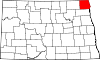 | |
| Townships | ||
| Unincorporated communities | ||
48°49′05″N 97°13′39″W / 48.81806°N 97.22750°W
| International | |
|---|---|
| National | |
This North Dakota location article is a stub. You can help Wikipedia by expanding it. |