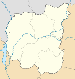
Pryluky Raion
Appearance
Pryluky Raion
Прилуцький район | |
|---|---|
| Coordinates: 50°33′38″N 32°18′33″E / 50.56056°N 32.30917°E | |
| Country | |
| Oblast | Chernihiv Oblast |
| Admin. center | Pryluky |
| Area | |
| • Total | 1,800 km2 (700 sq mi) |
| Population (2020) | |
| • Total | 34,406 |
| • Density | 19/km2 (50/sq mi) |
| Time zone | UTC+2 (EET) |
| • Summer (DST) | UTC+3 (EEST) |
| Website | http://pladm.cg.gov.ua/ |
Prylutskyi Raion (Ukrainian: Прилуцький район) is a raion (district) of Chernihiv Oblast, northern Ukraine. Its administrative centre is located at Pryluky which is incorporated as a city of oblast significance and does not belong to the raion. Population: 34,406 (2020 est.)[1]
References
![]() Media related to Pryluky Raion at Wikimedia Commons
Media related to Pryluky Raion at Wikimedia Commons
- ^ Чисельність наявного населення України на 1 січня 2020 року / Population of Ukraine Number of Existing as of January 1, 2020 (PDF) (in Ukrainian and English). Kyiv: State Statistics Service of Ukraine. Archived (PDF) from the original on 28 September 2023.


