
Paup, Arkansas
Paup, Arkansas | |
|---|---|
 Paup, Arkansas  Paup, Arkansas | |
| Coordinates: 33°30′07″N 93°56′34″W / 33.50194°N 93.94278°W | |
| Country | United States |
| State | Arkansas |
| County | Miller |
| Elevation | 259 ft (79 m) |
| Time zone | UTC-6 (Central (CST)) |
| • Summer (DST) | UTC-5 (CDT) |
| Area code | 870 |
| GNIS feature ID | 57154[1] |
Paup is an unincorporated community in Miller County, Arkansas, United States. Paup is located on U.S. Route 67, 7.8 miles (12.6 km) northeast of Texarkana.[2]
References
- ^ "Paup". Geographic Names Information System. United States Geological Survey, United States Department of the Interior.
- ^ Miller County, Arkansas General Highway Map (PDF) (Map). Arkansas State Highway and Transportation Department. 2010. Retrieved June 13, 2012.
Municipalities and communities of Miller County, Arkansas, United States | ||
|---|---|---|
| Cities | 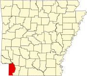 | |
| Town | ||
| CDP | ||
| Other unincorporated communities | ||
This article about a location in Miller County, Arkansas is a stub. You can help Wikipedia by expanding it. |